Share 44th Avenue Subarea Plan on FacebookShare 44th Avenue Subarea Plan on X (formerly Twitter)Share 44th Avenue Subarea Plan on LinkedinEmail 44th Avenue Subarea Plan link
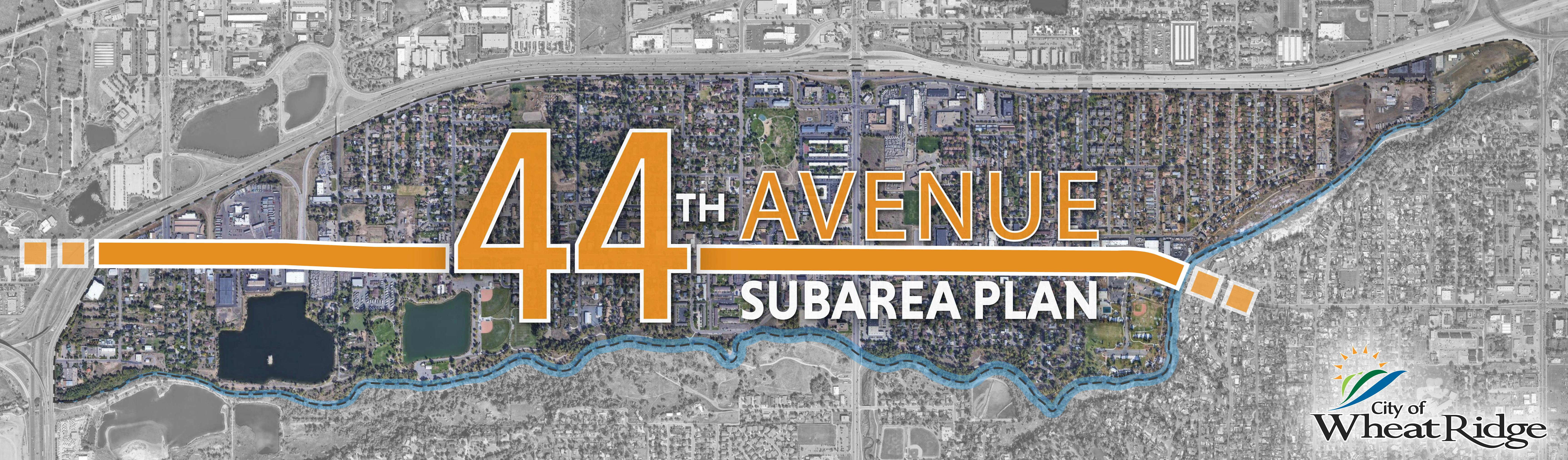
West 44th Avenue is one of the City's primary east-west corridors, and the 44th Avenue Subarea Plan provides a long-range plan for the western portion of the corridor and surrounding area from Clear Creek on the east to I-70 on the west. The Plan was adopted by Council in April of 2023.
The 44th Avenue Subarea Plan documents and background information can be viewed at the bottom of this page under Plan Documents and Public Process.
What's New?
One of the tasks in the 44th Avenue Subarea Plan Action Plan is to develop and implement a West 44th Avenue corridor brand and identity. In collaboration with over 35 stakeholders from the corridor, Localworks is proud to introduce Explore44, a vibrant business corridor identity spanning Wheat Ridge’s 44th Avenue.
Explore44 invites residents and visitors to discover the corridor's offerings, from parks and recreation spaces to unique dining destinations. The initiative aims to boost the economic vibrancy of the corridor by providing enhanced marketing opportunities for local businesses. The tagline, "Where history, creativity, and community intersect," reflects the corridor's evolution from a Gold Rush rest stop to a thriving hub deeply connected to Colorado's essence.
We asked for your input to pick a logo, and we had a close race with over 200 responses. Our winner, by a small margin, is this logo:
Keep an eye out on 44th Avenue in Wheat Ridge for this logo to start showing up on store windows, banners, and more!
Where are we now?
An essential goal of the subarea plan was to create a community-backed and realistic vision with clear next steps focused on revitalization and investment of the W. 44th Avenue corridor and surrounding area. The 44th Avenue Subarea Plan includes an Action Plan at the end of the subarea planning document that is intentionally focused on targeted implementation work that can be completed within 10 years. The Action Plan provides a road map for moving toward implementation quickly, and staff is now focused on moving actions forward. Since adoption, the following steps have been taken towards action as recommended by the subarea plan as of December 2023:
The Clearvale Urban Renewal Plan area was established in 2025, which includes the industrial area at the southeast corner of W. 48th Ave. and Carr Street, and aims to incentivize investment. Visit Renewal Wheat Ridge for more information.
Localworks has been working strategically with the City of Wheat Ridge on 'Explore 44' corridor identity/branding efforts.
Staff are working to identify funding for new signals/analysis and pedestrian crossing enhancements as recommended by the plan.
Parks is working on increasing accessibility to the Clear Creek Trail system along with the Open Space Management Plan recommendations. Examples of progress include Clear Creek Trail Improvements (improvements to the Trail section between Prospect Park and West Lake and Otis St. trailhead improvements), Tabor Lake trail construction and improved trail access at Van Gordon, seeking funding of feasibility studies at the Kipling/Trail intersection, and seeking funding for improving erosion and seepage issues underneath the 44th Ave bridge. See Parks Improvement Projects.
The City of Wheat Ridge is developing and implementing a comprehensive wayfinding and signage system along its seven-mile corridor of the regional Clear Creek Trail.
The Tabor bridge is also in process of being upgraded to better accommodate pedestrians and Tabor signal improvements are planned. Signal warrants are being studied by Public Works to determine priority signals and funding.
If you want to stay up to speed on planning efforts in the city, check out our City Plan page and subscribe for updates.
West 44th Avenue is one of the City's primary east-west corridors, and the 44th Avenue Subarea Plan provides a long-range plan for the western portion of the corridor and surrounding area from Clear Creek on the east to I-70 on the west. The Plan was adopted by Council in April of 2023.
The 44th Avenue Subarea Plan documents and background information can be viewed at the bottom of this page under Plan Documents and Public Process.
What's New?
One of the tasks in the 44th Avenue Subarea Plan Action Plan is to develop and implement a West 44th Avenue corridor brand and identity. In collaboration with over 35 stakeholders from the corridor, Localworks is proud to introduce Explore44, a vibrant business corridor identity spanning Wheat Ridge’s 44th Avenue.
Explore44 invites residents and visitors to discover the corridor's offerings, from parks and recreation spaces to unique dining destinations. The initiative aims to boost the economic vibrancy of the corridor by providing enhanced marketing opportunities for local businesses. The tagline, "Where history, creativity, and community intersect," reflects the corridor's evolution from a Gold Rush rest stop to a thriving hub deeply connected to Colorado's essence.
We asked for your input to pick a logo, and we had a close race with over 200 responses. Our winner, by a small margin, is this logo:
Keep an eye out on 44th Avenue in Wheat Ridge for this logo to start showing up on store windows, banners, and more!
Where are we now?
An essential goal of the subarea plan was to create a community-backed and realistic vision with clear next steps focused on revitalization and investment of the W. 44th Avenue corridor and surrounding area. The 44th Avenue Subarea Plan includes an Action Plan at the end of the subarea planning document that is intentionally focused on targeted implementation work that can be completed within 10 years. The Action Plan provides a road map for moving toward implementation quickly, and staff is now focused on moving actions forward. Since adoption, the following steps have been taken towards action as recommended by the subarea plan as of December 2023:
The Clearvale Urban Renewal Plan area was established in 2025, which includes the industrial area at the southeast corner of W. 48th Ave. and Carr Street, and aims to incentivize investment. Visit Renewal Wheat Ridge for more information.
Localworks has been working strategically with the City of Wheat Ridge on 'Explore 44' corridor identity/branding efforts.
Staff are working to identify funding for new signals/analysis and pedestrian crossing enhancements as recommended by the plan.
Parks is working on increasing accessibility to the Clear Creek Trail system along with the Open Space Management Plan recommendations. Examples of progress include Clear Creek Trail Improvements (improvements to the Trail section between Prospect Park and West Lake and Otis St. trailhead improvements), Tabor Lake trail construction and improved trail access at Van Gordon, seeking funding of feasibility studies at the Kipling/Trail intersection, and seeking funding for improving erosion and seepage issues underneath the 44th Ave bridge. See Parks Improvement Projects.
The City of Wheat Ridge is developing and implementing a comprehensive wayfinding and signage system along its seven-mile corridor of the regional Clear Creek Trail.
The Tabor bridge is also in process of being upgraded to better accommodate pedestrians and Tabor signal improvements are planned. Signal warrants are being studied by Public Works to determine priority signals and funding.
If you want to stay up to speed on planning efforts in the city, check out our City Plan page and subscribe for updates.
Share Plan Documents on FacebookShare Plan Documents on X (formerly Twitter)Share Plan Documents on LinkedinEmail Plan Documents link
The 44th Avenue Subarea Plan outlines a 20-year vision for the area between Clear Creek and I-70 and is based on twelve months of input from Wheat Ridge businesses, organizations and community members. This plan addressed the need to develop comprehensive strategies that 1) promote revitalization and attract investment to the W. 44th Avenue corridor and 2) enhance the adjacent neighborhoods and the City as a whole. The plan reflects and builds upon input from the 2019 Neighborhood Revitalization Strategy and from the ongoing Let’s Talk resident engagement program.
The 44th Avenue Subarea Plan was adopted by City Council in April of 2023, and it can be viewed at the following links:
The 44th Avenue Subarea Plan outlines a 20-year vision for the area between Clear Creek and I-70 and is based on twelve months of input from Wheat Ridge businesses, organizations and community members. This plan addressed the need to develop comprehensive strategies that 1) promote revitalization and attract investment to the W. 44th Avenue corridor and 2) enhance the adjacent neighborhoods and the City as a whole. The plan reflects and builds upon input from the 2019 Neighborhood Revitalization Strategy and from the ongoing Let’s Talk resident engagement program.
The 44th Avenue Subarea Plan was adopted by City Council in April of 2023, and it can be viewed at the following links: