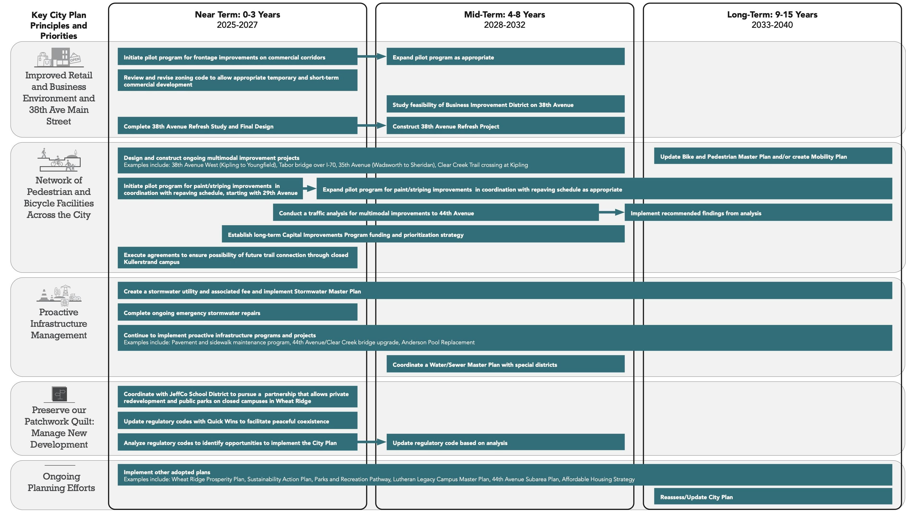
Skip To

  • Skip to content
  • Jump to navigation
  • Search

Page Outlines

Loading...

    Globe

    IE10 and below are not supported.

    Google Chrome Mozilla Firefox

    Contact us for any help on browser support

    Map showing a section of Wheat Ridge with "Wheat Ridge City Plan" written on the right hand side

    You are here:

    • Home
    • City Plan: A New Comprehensive Plan for Wheat Ridge

    Images

    Mobility Map
    previous next
    A map of Wheat Ridge illustrating the draft mobility framework, which envisions how the existing network can be incrementally improved to create a complete network of travel corridors, including options from regional travel all the way down to pedestrian paths and neighborhood connections.
    A map of Wheat Ridge illustrating the four categories of residential place types. This map categorizes distinct neighborhoods into categories based on the amount of variety of housing types found in parts of the city.
    A map of Wheat Ridge illustrating the four categories of mixed use and commercial places. These are the places where we shop, eat, visit the doctor, go to work, recreate, or meet up with friends.
    A draft place type map. A place type map describes the character and anticipated or desired uses of areas of the city.
    Mobility Map
    Mobility Toolkit
    Implementation_Graphic 2.jpg