

Alternatives A and B
The two alternatives differ in the Western Gateway & Main Street Core and the Main Street Transition. The final design does not necessarily need to follow one alternative in its entirety. The project team may combine elements from both alternatives to create a design that best fits each area. Decisions about which features to include will consider feasibility, budget, available right-of-way, and community feedback as the project moves forward.
Western Gateway & Main Street Core
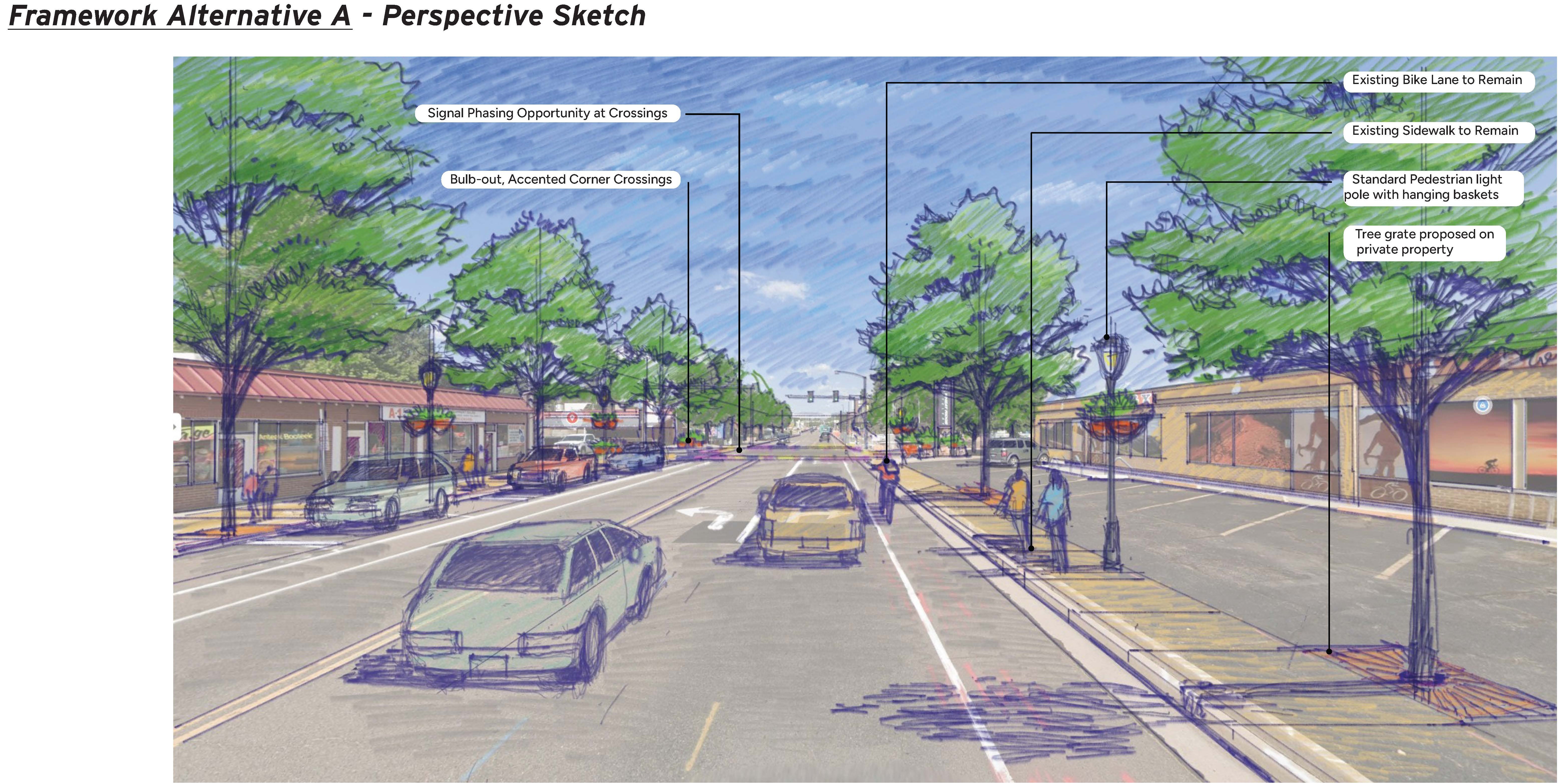
Alternative A takes a more targeted approach. The existing roadway flowline — essentially where the curb and gutter are located — would remain largely unchanged, which means less construction complexity. Existing sidewalks would largely remain, with improvements made where needed. Bike lanes would remain between Upham and Pierce, although there is not enough space to provide bike lanes between Wadsworth and Upham. Existing parking would also mostly remain. This alternative would provide moderate improvements to accessibility, pedestrian safety, and the streetscape, including some planting islands and additional trees.
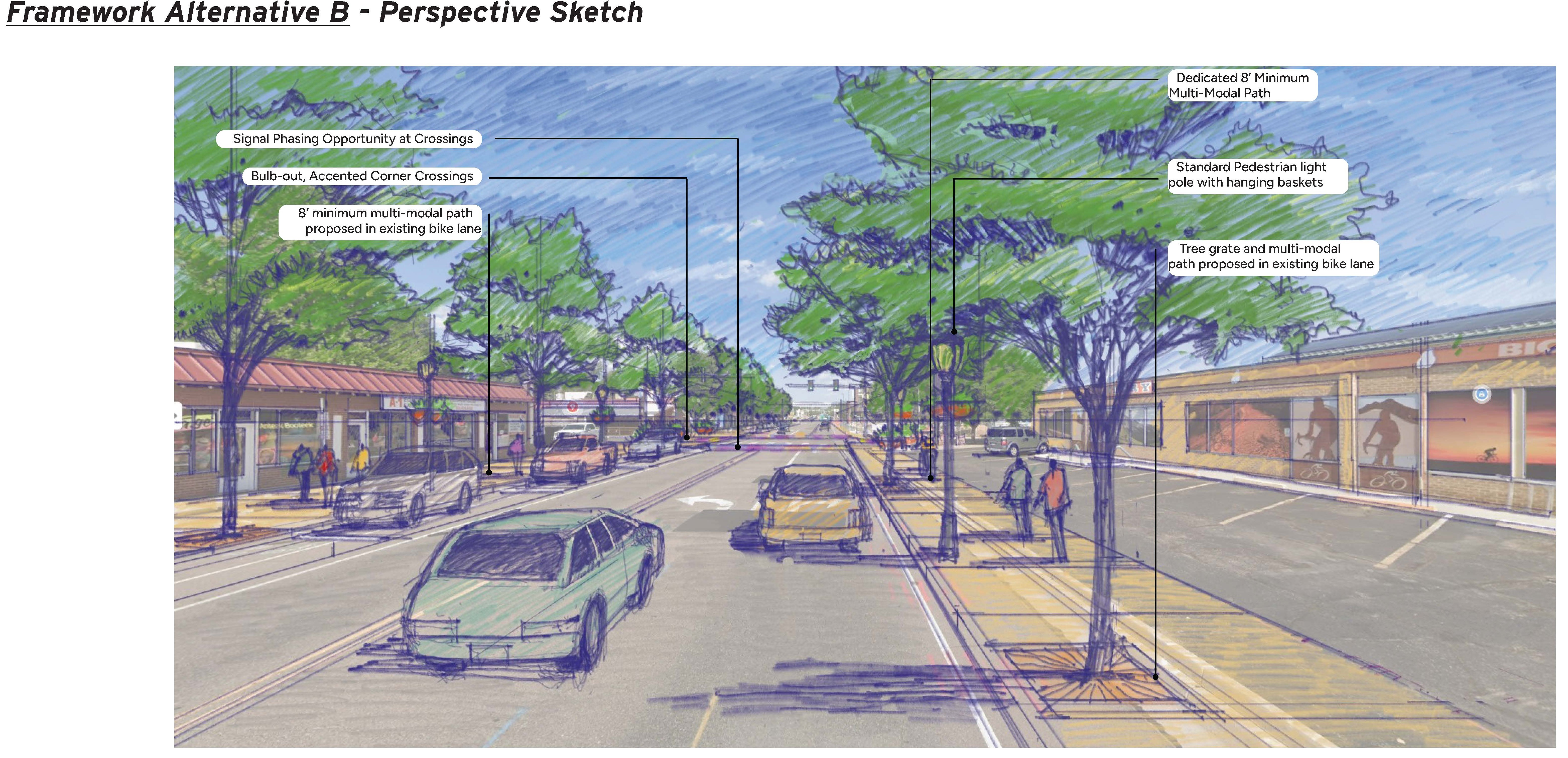
Alternative B takes a more comprehensive approach to the pedestrian and bicycle experience. The roadway flowline would be changed in some areas to create more space for people walking and biking. Between Wadsworth and Pierce, bike facilities would move to a dedicated 8-foot multimodal path, creating a more consistent route along this portion of the corridor. Sidewalks would also be more consistent, and the wider pedestrian realm would provide greater accessibility and pedestrian comfort. Alternative B would add more tree canopy and streetscape improvements and would increase parking along The Green at 38th.
The biggest difference between the alternatives is the extent of the improvements and the resulting construction complexity. Alternative A works largely within the existing roadway layout, allowing for targeted improvements with less construction. Alternative B makes more significant changes to the roadway and pedestrian space, creating greater opportunities for improvements to accessibility, pedestrian experience, parking, and the overall streetscape. These additional improvements would also require more extensive construction, a higher level of complexity, and approval by City Council to change the flowline.
Main Street Transition
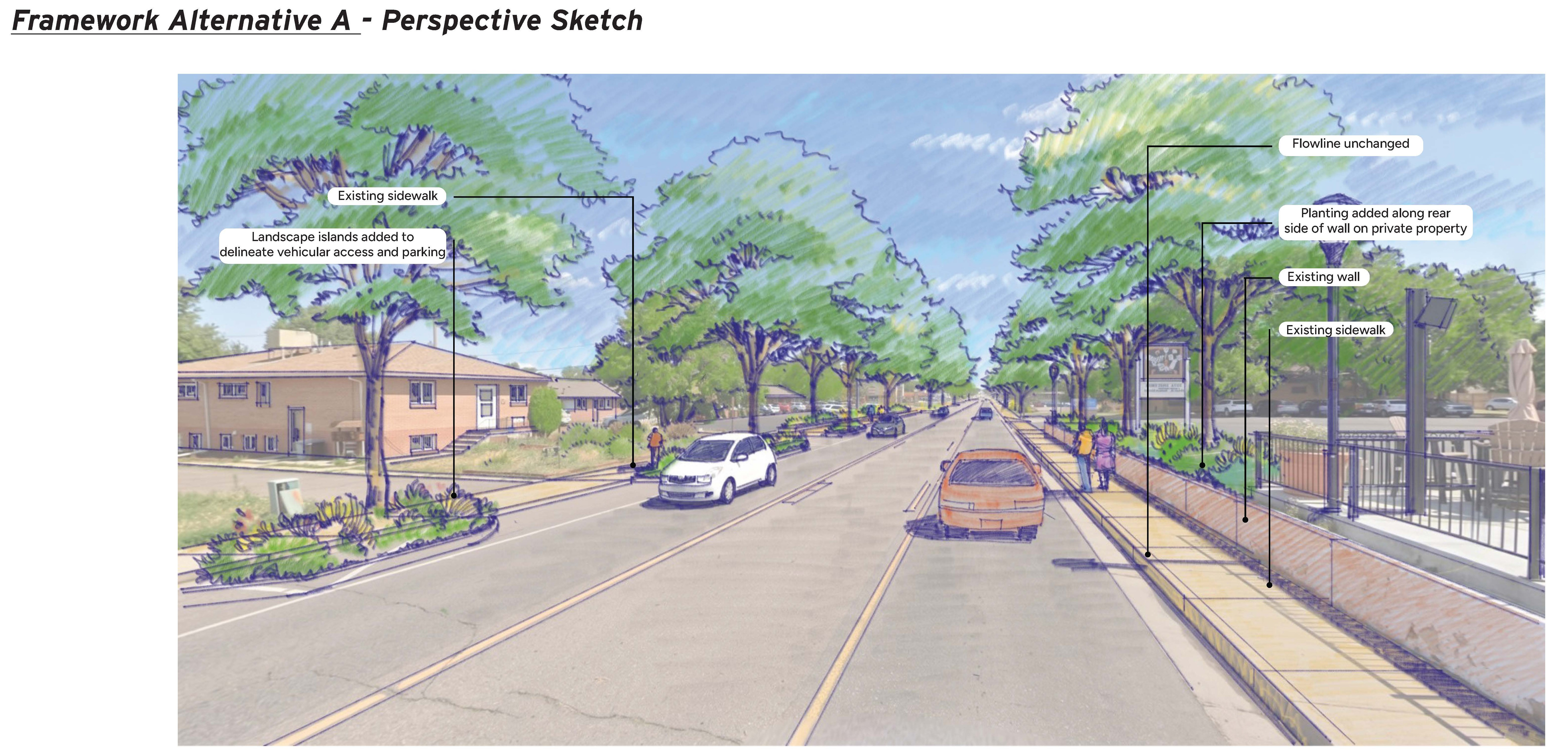
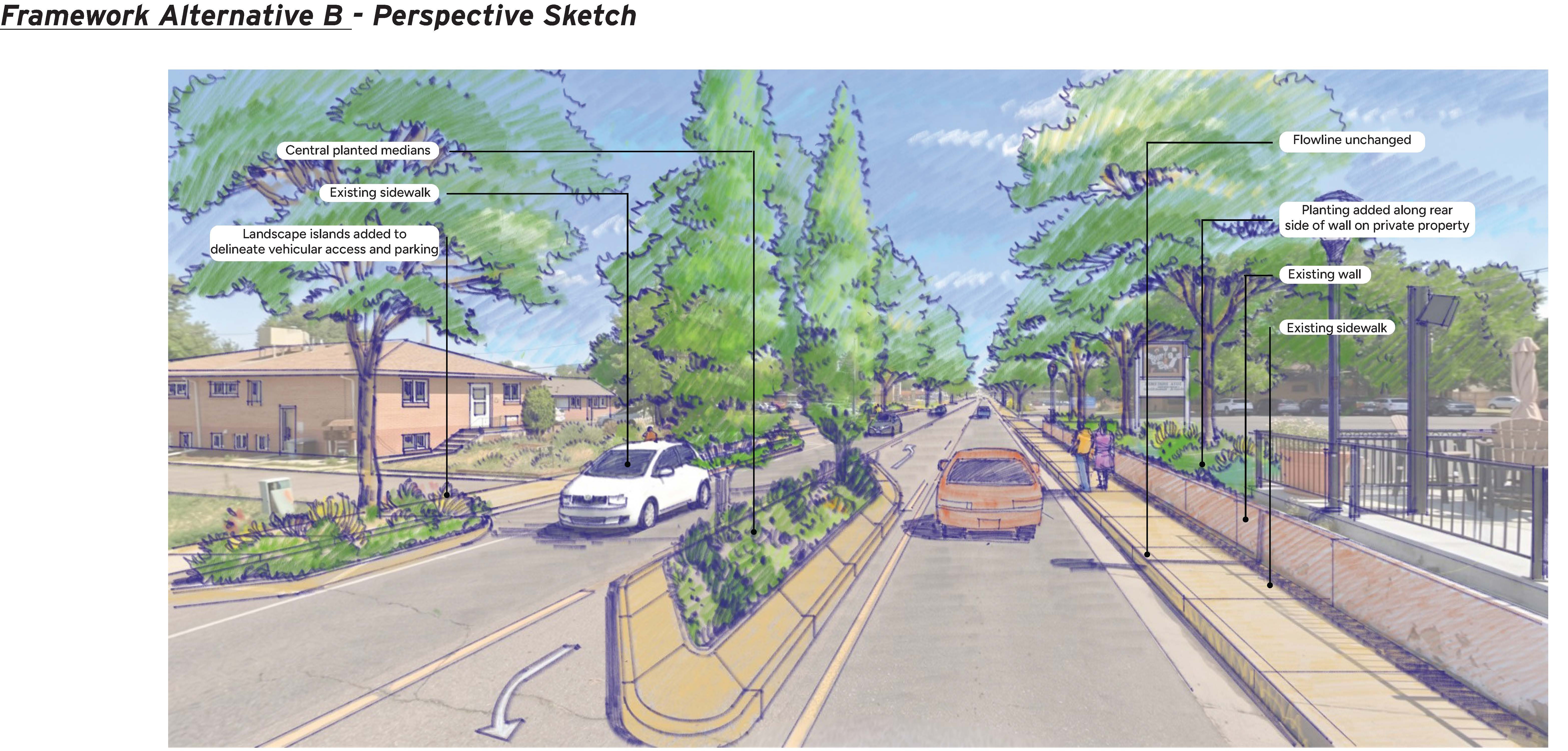
Here, the main difference between Alternatives A and B is the addition of landscaped mini-medians throughout this section. Both alternatives keep the existing roadway flowline and largely retain the existing sidewalks. Both also look to limit driveways and access points where appropriate, add corner bulb-outs where feasible, provide a pedestrian refuge at the Kendall Street crosswalk, and use landscaped islands to help separate parking and access points while adding visual interest.
Boulevard Commercial & Eastern Gateway
The improvements in this section are more targeted. However, the Refresh does not stop at Harlan Street. Proposed improvements will transition into the already improved area between Harlan Street and Sheridan Boulevard, creating a more cohesive experience along the full corridor. There is no difference between Alternatives A and B in this section.
Explore the alternatives in more detail here.

Thank you for your contribution!
Help us reach out to more people in the community
Share this with family and friends